Ridge Meadows Search and Rescue is warning the public not to follow online maps of the Golden Ears Mountain, because they could lead you to a helicopter rescue.
Rick Laing, RMSAR search manager, said twice this year his group was called to rescue hikers stranded on the mountain in Golden Ears Provincial Park.
The problem is a dangerous trail frequently marked on online maps called the Golden Ears-Blanshard Needle Traverse. It looks like a simple trail, but there are major problems with it, said Laing.
Firstly, it is not a clearly marked trail, and is not easy for an inexperienced hiker to follow.
ŌĆ£ItŌĆÖs not a trail, itŌĆÖs a traverse ŌĆō so there is no worn pathway,ŌĆØ explained Laing. ŌĆ£YouŌĆÖre picking your way along, from boulder to boulder.ŌĆØ
Secondly, following the map can lead hikers to an area where it is unsafe to continue, but they canŌĆÖt climb back. They are forced to call for help.
ŌĆ£People have gotten so far along the ŌĆśtrail,ŌĆÖ and then they find out it takes ropes and climbing expertise to get out,ŌĆØ said Laing.
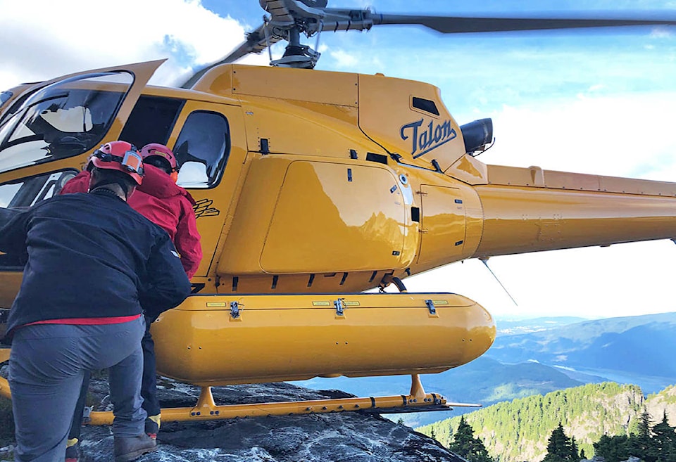
Twice this has happened in recent months. In August, a woman who had summited on Golden Ears had to be rescued on her descent. The RMSAR team with ropes and climbing gear, got her to a location where Talon Helicopters could airlift her out.
READ ALSO:
In September, a trio of hikers was stranded among the rocky boulders of Edge Peak, and forced to spend a night on the mountain before a helicopter rescue the next morning. Fortunately, they had already spent a night in the back country, and had the necessary gear.
ŌĆ£If people arenŌĆÖt prepared (to spend a night), they could be in trouble,ŌĆØ said Laing.
READ ALSO:
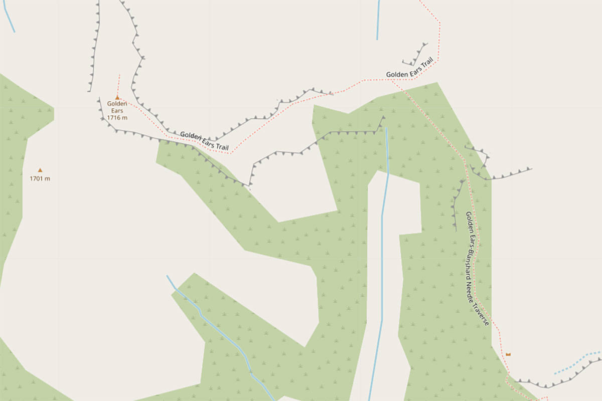
One of the problem maps can be found on openstreetmap.org, which is a collaborative mapping site. It shows the Golden Ears Trail going to the summit, but also the problematic offshoot Golden Ears-Blanshard Needle Traverse, which appears to take hikers to Edge Peak and Blanchard Peak.
LaingŌĆÖs advice is for hikers to stick to the Golden Ears Trail, which is easy to follow and leads to the 1,716m peak of Golden Ears Mountain. Laing said parts of the trail are a logging skid trail, itŌĆÖs rocky terrain, and can be challenging.
ŌĆ£But once you get up there, the view is spectacular,ŌĆØ he said.
The return trip takes 12-13 hours, and many hikers spend a night camped at Panorama Ridge, near the emergency shelter.
Stick to Golden Ears Trail, and donŌĆÖt venture down the Golden Ears-Blanshard Needle Traverse, unless you are an experienced climber with climbing gear, he recommends.
There are other collaborative mapping sites, such as alltrails.com, which also show the not-recommended Golden Ears-Blanshard Needle Traverse as a trail.
ŌĆ£Really, itŌĆÖs up to the person hiking to verify itŌĆÖs a route theyŌĆÖre able to do,ŌĆØ said Laing.
ncorbett@mapleridgenews.com
Like us on and follow us on