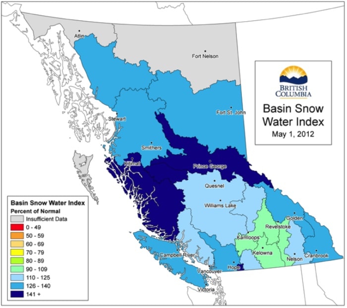
Heavy snow in B.C.'s Interior poses a risk of flooding in the Fraesr Valley this year, but much will depend on the weather patterns in the weeks ahead.
The entire Fraser River watershed has 29 per cent more snow than normal, as of the taken by the May 1.
And the upper Fraser and Nechako basins – which supply about a third of the Fraser water that flows through the Lower Mainland — are running at around 50 per cent above normal.
"There is an elevated flood risk present through the entire length of the mainstem of the Fraser River from the Robson Valley to the Fraser Valley," according to the centre's latest bulletin.
Some B.C. communities have already been hit with isolated flooding due to rising local creeks and rivers and forecasters say the risk of seasonal flooding later this spring is "exceptional" in some regions.
But they say the Fraser won't likely peak in the Lower Mainland until sometime between mid-May and late June or July, depending on the weather.
A lengthy run of hot temperatures, heavy rain or a combination of the two is described as the worst case scenario.
Floodplain dwellers should hope for seasonal temperatures and dry weather for the rest of the spring, particularly in the watershed's northern basins.
Above-normal temperatures are expected by this weekend.
Lower Mainland residents would have plenty of warning of any high water.
The River Forecast Centre runs computer simulations to generate five-day forecasts of flow the length of the Fraser.
Flood warnings are issued if rivers are forecast to approach or reach flood level.
by

Floodplain areas of the Lower Mainland are shown in white with standard dikes marked with red lines.


