Abbotsford’s air quality has taken a dive Thursday morning, due to wildfire smoke drifting into the region.
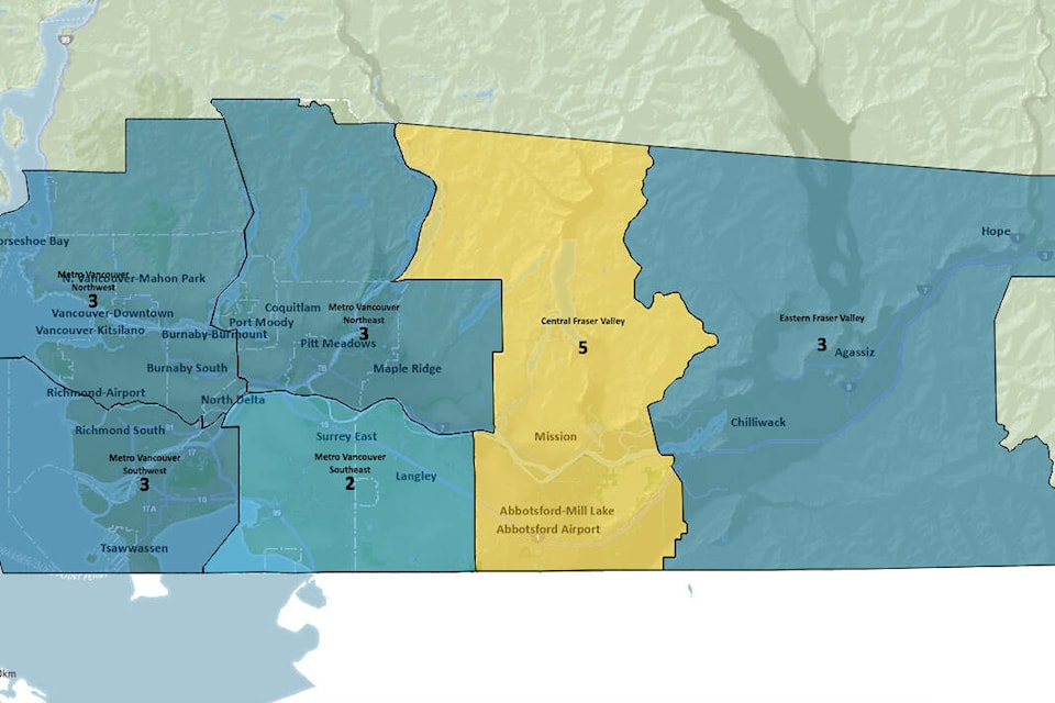
Environment Canada reports air quality hourly on a health index that generally runs from low risk at 1, to very high risk at 10 and above. At 8 a.m., they were reporting Abbotsford at 5, while the rest of the communities in the eastern Fraser Valley were still sitting at 3.
IQ Air, a website that reports particulates in the air, says Abbotsford’s PM2.5 levels are at a rate of more than nine times the World Health Organization’s healthy guidelines. It is listing Abbotsford’s AQI at 129, and “unhealthy for sensitive groups.”
Other measurements across the valley include Chilliwack at 79 AQI, and Hope at 55.
The worst air quality in Canada is currently Fort Nelson, with 338 AQI.
On Wednesday, the BC Lions moved their training camp indoors because of the smoke in Kamloops. Clear Air BC posts images of various cities to show the level of visibility at any given time. Abbotsford is currently rated as ‘poor,’ with an image of Mt. Baker barely visible through smog.
READ MORE:
jessica.peters@abbynews.com
Like us on and follow us on .


