Wildfires fueled by climate change have to the this summer, killing many people, exhausting firefighters and fueling demand for new solutions. Enter artificial intelligence.
Firefighters and startups are using AI-enabled cameras to scan the horizon for signs of smoke. A German company is building a constellation of satellites to . And Microsoft is to predict where the next blaze could be sparked.
With as the world warms, firefighters, utilities and governments are scrambling to get ahead of the flames by tapping into the — which has stirred both fear and excitement for its . While increasingly stretched first responders hope AI offers them a leg up, humans are still needed to check that the tech is accurate.
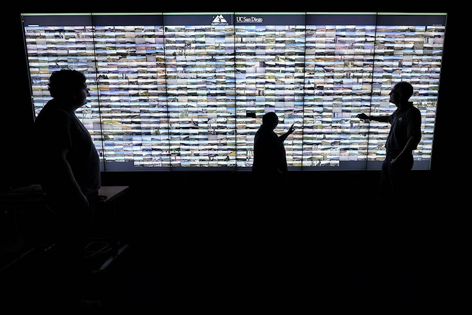
this summer started testing an AI system that looks for smoke from more than 1,000 mountaintop camera feeds and is now expanding it statewide.
The system is designed to find “abnormalities” and alert emergency command centers, where staffers will confirm whether it’s indeed smoke or something else in the air.
“The beauty of this is that it immediately pops up on the screen and those dispatchers or call takers are able to interrogate that screen” and determine whether to send a crew, said Phillip SeLegue, staff chief of intelligence for the California Department of Forestry and Fire Protection.
The cameras, part of a network that workers previously had to watch, provide billions of bytes of to digest. While humans still need to confirm any smoke sightings, the system helps reduce fatigue among staffers typically monitoring multiple screens and cameras, alerting them to look only when there’s possible fire or smoke, SeLegue said.
It’s already helped. A battalion chief got a smoke alert in the middle of the night, confirmed it on his cellphone and called a command center in San Diego to scramble first responders to the remote area.
The dispatchers said that if they hadn’t been alerted, the fire would have been much larger because it likely wouldn’t have been noticed until the next morning, SeLegue said.
San Francisco startup Pano AI takes a similar approach, mounting cameras on cell towers that scan for smoke and alert customers, including fire departments, utility companies and ski resorts.
The cameras use computer vision machine learning, .
“They’re trained very specifically to detect smoke or not, and we train them with images of smoke and images of not smoke,” CEO Sonia Kastner said.
The images are combined with feeds from government weather satellites that scan for hotspots, along with other data sources, such as social media posts.
The technology gets around one of the main problems in the traditional way of detecting wildfires — relying on 911 calls from passers-by that need confirmation from staffers before crews and water-dropping planes can be deployed.
“Generally, only one in 20 of these 911 calls are actually a wildfire. Even during fire season, it might be a cloud or fog or a barbecue,” Kastner said.
Pano AI’s systems do still rely on final confirmation, with managers playing a time lapse of the camera feed to ensure it’s smoke rising.
For fighting forest fires, “technology is becoming really essential,” said Larry Bekkedahl, senior vice president of energy delivery at Portland General Electric, Oregon’s largest utility and a Pano AI customer.
Utility companies sometimes play a role in sparking wildfires, when their by wind or struck by falling trees. Hawaii’s electric utility acknowledged that its this summer after apparently being downed by high winds.
PGE, which provides electricity to 51 cities in Oregon, has deployed 26 Pano AI cameras, and Bekkedahl said they have helped speed up response and coordination with emergency services.
Previously, fire departments were “running around looking for stuff and not even really knowing exactly where it’s at,” he said. The cameras help detect fires quicker and get teams on the ground faster, shaving up to two hours off response times.
“That’s significant in terms of how fast that fire can can spread and grow,” Bekkedahl said.
Using AI to detect smoke from fires “is relatively easy,” said Juan Lavista Ferres, chief data scientist at Microsoft.
“What is not easy is to have enough cameras that cover enough places,” he said, pointing to vast, remote areas in northern Canada that have burned this summer.
Ferres’ team at to predict where fires are likely to start. They have fed the model with maps of areas that burned previously, along with climate and geospatial data.
The system has its limitations — it can’t predict random events like a lightning strike. But it can sift through historical weather and climate data to identify patterns, such as areas that are typically drier. Even a road, which indicates people are nearby, is a risk factor, Ferres said.
“It’s not going to get it all perfectly right,” he said. “But what it can do is it can build a probability map (based on) what happened in the past.”
The technology, which Microsoft plans to offer as an open source tool, can help first responders trying to figure out where to focus their limited resources, Ferres said.
Another company is looking to the heavens for a solution. German startup OroraTech analyzes satellite images with artificial intelligence.
Taking advantage of advances in camera, satellite and AI technology, OroraTech has launched two mini satellites about the size of a shoebox into low orbit, about 550 kilometers (340 miles) above Earth’s surface. The Munich-based company has ambitions to send up eight more next year and eventually put 100 into space.
As this year, OroraTech said it provided thermal images at night when aerial drones are used less frequently.
Weeks after OroraTech launched its second satellite, it detected a fire near the community of Keg River in northern Alberta, where of boreal forest repeatedly this summer.
“There are algorithms on the satellite, very efficient ones to detect fires even faster,” CEO Thomas Gruebler said.
The AI also takes into account vegetation and humidity levels to identify flare-ups that could spawn devastating megafires. The technology could help thinly stretched firefighting agencies direct resources to blazes with the potential to cause the most damage.
“Because we know exactly where the fires are, we can see how the fires will propagate,” Gruebler said. “So, which fire will be the big fire in one day and which will stop on their own.”


